
Partner:
University of Milan – Department of Computer Science
Milan Living Lab
The Living Lab is promoted by the Computer Science Department of the University of Milan. It explores new dynamics of the open spaces as a value-added service for the community, paying attention to the parties interested, to the local context and to the different social groups.
The idea developed by the team is a vibrant new way to create a community that could really communicate and help and grow not only virtually but also in presence by means of technology.
Contributions of the University of Milan to the C3Places Project are various. The main task was the development of a co-creation platform providing a scientifically validated framework for citizens’ interaction in and with public spaces, leveraging their diversity potential of cocreation.
Smart Co-design. An interdisciplinary approach to urban planning via Augmented/Virtual Reality and process mining
Authors: Barbara Piga, Marco Boffi, Nicola Rainisio, Gabriele Stancato, Paolo Ceravolo, Gabriel Marques Tavares
In the field of urban planning and design, citizens’ involvement has undergone a constant evolution. This has taken place in quantitative terms, with an increasing number of citizens involved in each urban transformation, together with a greater number of initiatives for collaborative approaches (Davies et al., 2012). Such evolution is also qualitative, as more attention is nowadays devoted to disadvantaged social minorities and citizens are more often considered as partners rather than passive observers (Bisschops & Beunen, 2019). In this context, the opportunities offered by ICT solutions have represented a natural field of expansion for these practices. This process has been further strengthened by the rapid and widespread diffusion of mobile devices, which allow building networks interconnecting different actors, at the same time and in different places, among them and with the city. Moreover, such interaction between urban planning and ICT has produced several innovations in terms of services offered to the citizens (Dunn, 2007; Piga et al., 2021).
Yet, the role of the social sciences has so far been partial in those initiatives, despite the proximity of some research issues. In particular, environmental and community psychology developed several theoretical concepts and measurement tools relevant for this field. Thanks to their implementation, the relationships of individuals within a community and with the physical environment in which they live can be effectively described. This union between the physical and intangible components of the places we live has rarely been effectively integrated into applied tools (Boffi & Rainisio, 2017). At the intersection of these different perspectives on experiential urban planning (Piga, 2017) lies the starting point of the collaboration between the Università degli Studi di Milano and the Politecnico di Milano.
It was further developed thanks to the “AR4CUP: Augmented Reality for Collaborative Urban Planning” projects (2019 and 2020), part of the H2020 EIT Digital (Digital Cities) funding program whose Italian partnership was led by the Politecnico di Milano. The objective of the project is to support the design of urban spaces, through an app (AR4CUP) that makes people’s urban experiences evident and quantifiable using synchronous behavioral data (Seeber, 2014).
In a nutshell, this smart co-design approach fosters the inclusion of the urban communities perspectives in the design process. Mixed Reality is exploited to combine real and virtual environments (Carmignani et al., 2011). The result is a combination of information coming directly from the real environment with information coming from design artifacts: data are collected recording the user response to this mixed reality in real-time. Indeed, the app has different functions that enable its application throughout an entire co-design process:
- it shows, on-site through Augmented Reality and off-site through Virtual Reality, urban and architectural proposals geolocated in real dimensions before their actual implementation; it also allows to explore the current condition of the neighborhood;
- it collects data from citizens’ reactions to proposed urban transformations or to the current environment, combining emotional, cognitive and behavioral factors through scientifically validated instruments;
- it develops automatic data analytics to study the user’s behavior, to verify its conformance with the design goals and to identify space utilization not explicitly considered by the design plans;
- it represents the outcomes in various forms, including charts and maps of the places as they are subjectively perceived.
The app and its outcomes are conceived as a tool for facilitating the interaction among stakeholders of urban transformations (e.g. Architectural Firms, Real Estate Developers), institutions (e.g. Local Public Administrators, Regional or National authorities) and citizens (e.g. dwellers, commuters, tourists). It eases the creation of a shared representation of places, combining together objective environmental features and subjectively perceived values. Such common ground is crucial for informing designers and decision-makers about citizens’ needs, which might impact on the project development. In addition, it is a way to effectively inform citizens and actively engage them in the urban transformation from the very beginning of the process.
References
- Bisschops, S., & Beunen, R. (2019). A new role for citizens’ initiatives: The difficulties in co-creating institutional change in urban planning. Journal of Environmental Planning and Management, 62(1), 72–87.
- Boffi, M., & Rainisio, N. (2017). To Be There, Or Not To Be. Designing Subjective Urban Experiences. In Urban Design and Representation (pp. 37-53). Springer, Cham.
- Carmigniani, J., Furht, B., Anisetti, M., Ceravolo, P., Damiani, E., & Ivkovic, M. (2011). Augmented reality technologies, systems and applications. Multimedia tools and applications, 51(1), 341-377.
- Davies, S. R., Selin, C., Gano, G., & Pereira, Â. G. (2012). Citizen engagement and urban change: Three case studies of material deliberation. Cities, 29(6), 351–357.
- Dunn, C. E. (2007). Participatory GIS — a people’s GIS? Progress in Human Geography, 31(5), 616–637.
- Piga, B. E. (2017). Experiential simulation for urban design: From design thinking to final presentation. In Urban Design and Representation (pp. 23-36). Springer, Cham.
- Van Der Aalst, W., Adriansyah, A., De Medeiros, A. K. A., Arcieri, F., Baier, T., Blickle, T., … & Burattin, A. (2011, August). Process mining manifesto. In International Conference on Business Process Management (pp. 169-194). Springer, Berlin, Heidelberg.
An example of digitally shared infrastructure creating a partecipatory community in an urban open spaces
Author: R. Pizzi
An open project of the Department of Computer Science of the University of Milan, PEOPLE HAVE THE POWER , in collaboration with the Polytechnic University of Milan (Department of Architecture, Construction Engineering and Built Environment) has proposed a geolocalized app that allows to find in the vicinity of your vehicle private buildings available to lend an electric outlet for charging electric vehicles, especially in yards, garages or parking spots.
As shown in the dedicated platform, the app allows individuals, companies or commercial activities to register, describe their service, arrange payment via PayPal or credit card, or promote their charging spots with scores collection and exchange, discounts etc.
Users can use the recharge service while leaving the vehicle for commissions or for leisure, or during a holiday trip or when stopping for the night.
The project was developed and a charging point was realized in the “Study City” Campus and has become a point of interest of the Social Campus platform (Figures 1, 2, 3, 4)
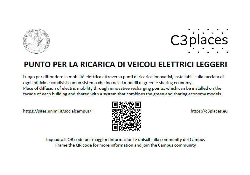
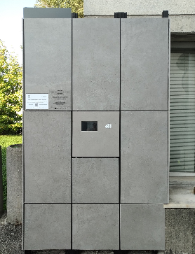
Figure 1: Social Campus: the QR code tag of the Smart charging point for soft electric vehicles.
Figure 2: The Smart charging point, inserted in the facade of the building.
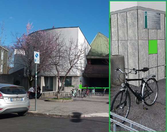
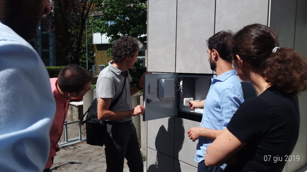
Figure 3: Smart charging point position.
Figure 4: Smart charging point close-up view.
Social Campus
Author: R. Pizzi
The platform was created by the Department of Computer Science of the dell’Università degli Studi di Milano of the as part of the C3Places European Project, which aims to develop strategies and tools to increase the quality of open public spaces through the information and communication technologies. This platform aims to create a community of students, teachers and citizens who attend the Città Studi Campus and its open spaces.
On this web site you can ask, receive and yield information on the various places of interest scattered around the area simply by registering.
Entering the dedicated pages it will be possible to interact with the registered members that share the same interests. In the groups section you will be able to communicate with the registered members (Figure 1). The group page can also be reached by scanning the QR code on the plate affixed in proximity to the point of interest (Figures 2 and 3).
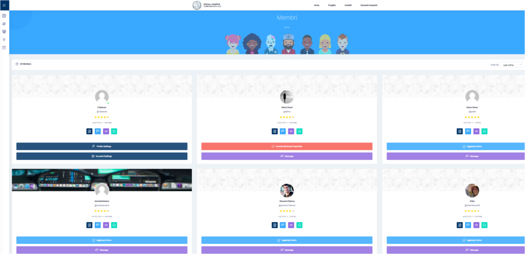

Figure 1: Social Campus view of the members page and of a chat between members.


Figure 3: Social Campus: an example of QR code tag.
The University of Milan contribution to the C3Places Project
Author: R. Pizzi
The presentation at the link describes the idea developed by the UNIMI team: a vibrant new way to create a community that could really communicate and help and grow not only virtually but also in presence *by means* of technology.
Urban open space can easily become center of shared services and cultural events and opportunities and knowledge (Figure 1).
The availability of public hot spots in public places can be seen as a social service, where digital infrastructures may become a way for the supply of public services, ideas, creativity, opportunities for co-creation and collective cultural and social interchange, promoting sustainability, responsibility and knowledge of nature, the city and citizenship in its cultural diversity.
University of Milan main task in C3Places project was the development of a co-creation platform providing a scientifically validated framework for citizens’ interaction in and with public spaces, leveraging on their diversity potential of co-creation.
A social network built around points of interest of public open spaces, where people can exchange usefule information, moods, requests, ideas.
A complete example has been developed and experiment, yield the novel digital tool to students of the Campus, open also to the citizens living in the area.
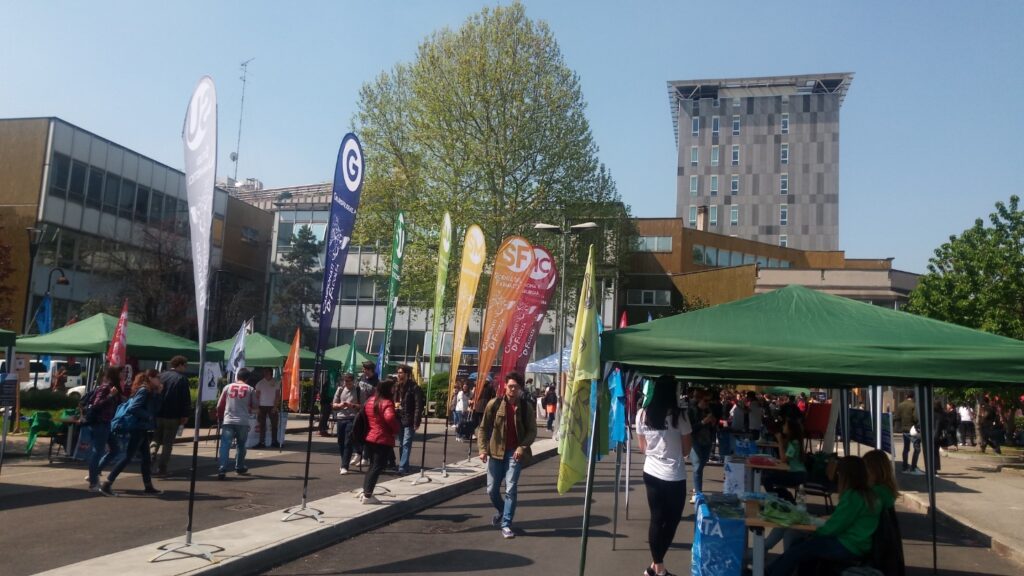
Figure 1: View of the “Città Studi” area.
Participatory co-creation and urban sustainability: the role of cooperation in the ICT era
Authors: R. Pizzi, A. Merletti De Palo
In the last decade Information and Communication Technologies (ICT) have become an important tool for socialization. However, living public open spaces firsthand remains fundamental for the development of the cultural identity of a community. ICT allows to develop strategies and tools to increase the quality of public open spaces, positively influencing the co-participatory creation and the effects of social cohesion (Figure 1).
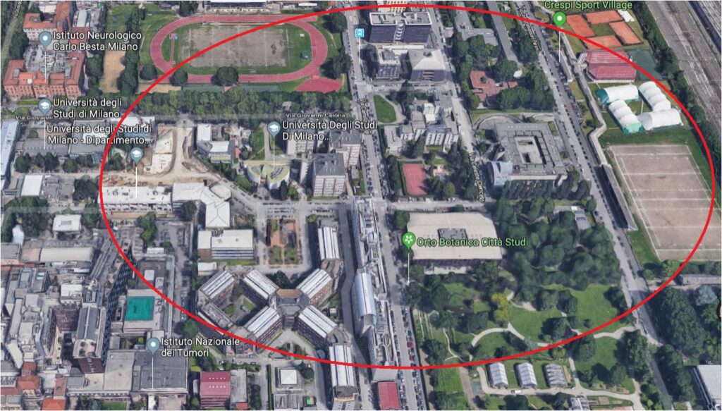
Figure 1: The university area “Città Studi” where the Social Campus points of interest are located.
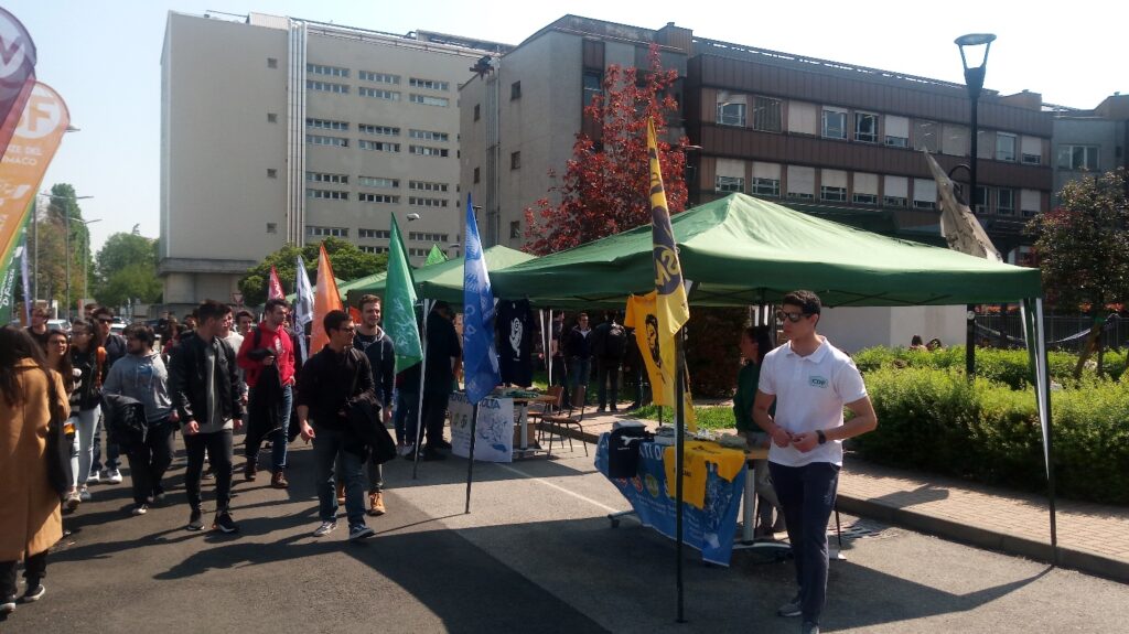
As part of a European research project called C3Places, we intend to generate knowledge and knowhow for a co-creation approach to be used to combine the use of ICT and the studies on cooperation with the essential functions and new potential of the public open spaces (Figures 2 and 3).
We explored the new dynamics of the open spaces as a value-added service for the community, paying attention to the parties interested, to the local context and to the different social groups.
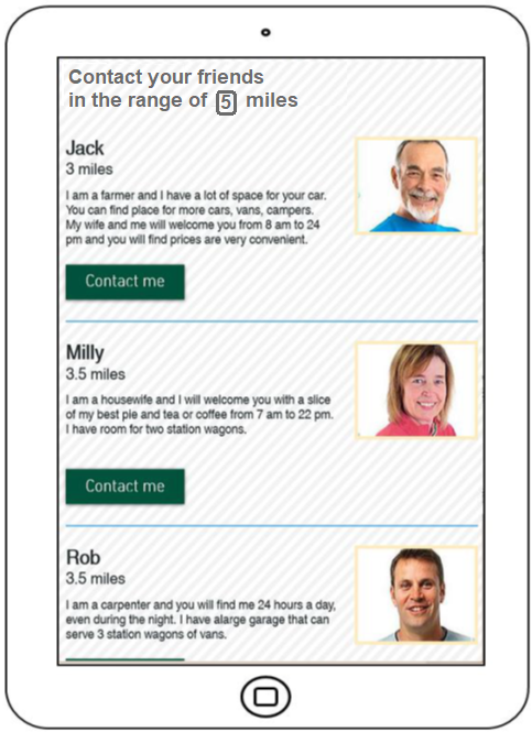
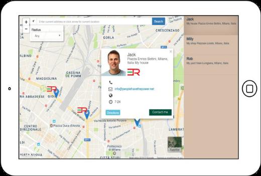
Figure 2: App interface: services and contacts of the private charging points.
Figure 3: The private charging points are geolocalized.
Co-Creazione partecipativa e Sostenibilità Urbana: il Ruolo della Cooperazione nell’Era dell’ICT 2018 / R. Pizzi, A. Merletti De Palo – In: Città Sostenibili / [a cura di] C. Fiamingo, V. Bini, A. Dal Borgo. – Prima edizione. – Broni : Altravista, 2018 Dec. – ISBN 9788899688400.
ICT-Based Participatory Co-Creation of Urban Sustainability
Author: Rita Pizzi
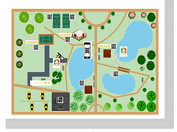
In recent times Information and communication technologies (ICT) have become an important tool for socialization. More and more people build and maintain relationships through various social media and increasingly this influences the way they organize their daily lives and how they use the city and its spaces. However, the quality of public open spaces remains fundamental for the development of the cultural identity of a community, as they are important gathering points in the urban fabric and offer occasion for interactions and collaborations between generations and different ethnic diversities. People of all ages still need contact with nature and with other people, in order to develop different life skills, values, attitudes to health, satisfaction with their lives and responsibility towards the environment. ICTs allow the development of strategies and tools to increase the quality of public open spaces, positively influencing participatory co-creation and the effects of social cohesion. New ways of cooperative co-creation must be considered, in particular by using ICT to facilitate community interaction and engagement for the integration of diversity, and identifying social needs in open public spaces, aiming at the development of vibrant and accessible urban communities.ICT gives also the opportunity to the urban communities to improve sustainability.This paper presents best practices and new ICT solutions for enjoyable, inclusive, participatory, sustainable urban spaces.

ICT-based Participatory Co-Creation of Urban Sustainability / R.M.R. Pizzi. – In: INTERNATIONAL JOURNAL OF COMPUTER APPLICATIONS. – ISSN 0975-8887. – 182:30(2018 Dec), pp. 30-35.
